ALL your maps, from all your displays, in one place.
View maps from third party displays
Run a mixed fleet and want your maps in one convenient place? Now you can upload and view maps and reports for many of the latest third party displays instantly within AgFiniti.
Connect to other digital platforms
AgFiniti connects with other digital platforms to enable you to seamlessly map, report, and analyze all your information in one place anytime, anywhere, and on any device.

FREE
View data on the go with AgFiniti Mobile for iPad:
- View your maps anytime, anywhere
- Sync with the InCommand display
- Overlay maps to identify trends
- Basic analysis tools like queries, field summaries
- Take pictures and notes
- Print maps and reports
Added free features for your display and phone:
- Email files
- Wireless file transfer (up to 5 GB) w/ supported displays
- Share files individually or automatically with the AgFiniti app
- Automatic firmware updates
- Background satellite imagery on display
- Allows display to be remotely viewed, controlled
AgFiniti Essentials
$350/year
Connect your entire operation for real-time decision support:
- View field progress with live maps and key stats*
- Sync displays with information (e.g., configurations, boundaries, and guidance lines)*
- Easily track the location of your machines and personnel
- View and control InCommand displays remotely
- CartACE®*
- Sync files with John Deere Operations Center, Climate FieldView, CNH third-party applications, and others integrated with the AgFiniti API
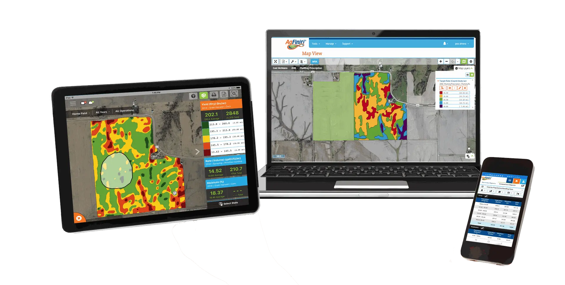
Data management on any device:
- Sync maps across all AgFiniti apps for viewing anytime, anywhere
- Create and share simple prescriptions
- Take pictures and notes
- Print reports
- Share files individually or automatically
- Simple data editing and management
- Connect to third-party applications (e.g., John Deere Operations Center and Climate FieldView) or upload all your maps in one place
- Cloud storage (6000 acres and 250 GB, additional acres and storage available for purchase)
Analysis:
- Overlay maps to easily identify trends
- View yield by hybrid, soil type, and population
- Generate equation-based prescriptions**
- View automatically generated multi-year analysis**
A software solution for every season
Precision farming is about answering questions that can make you more profitable in all your field activities. SMS Software
is an easy-to-use, decision-making tool that helps you get the most out of every acre.

![]()
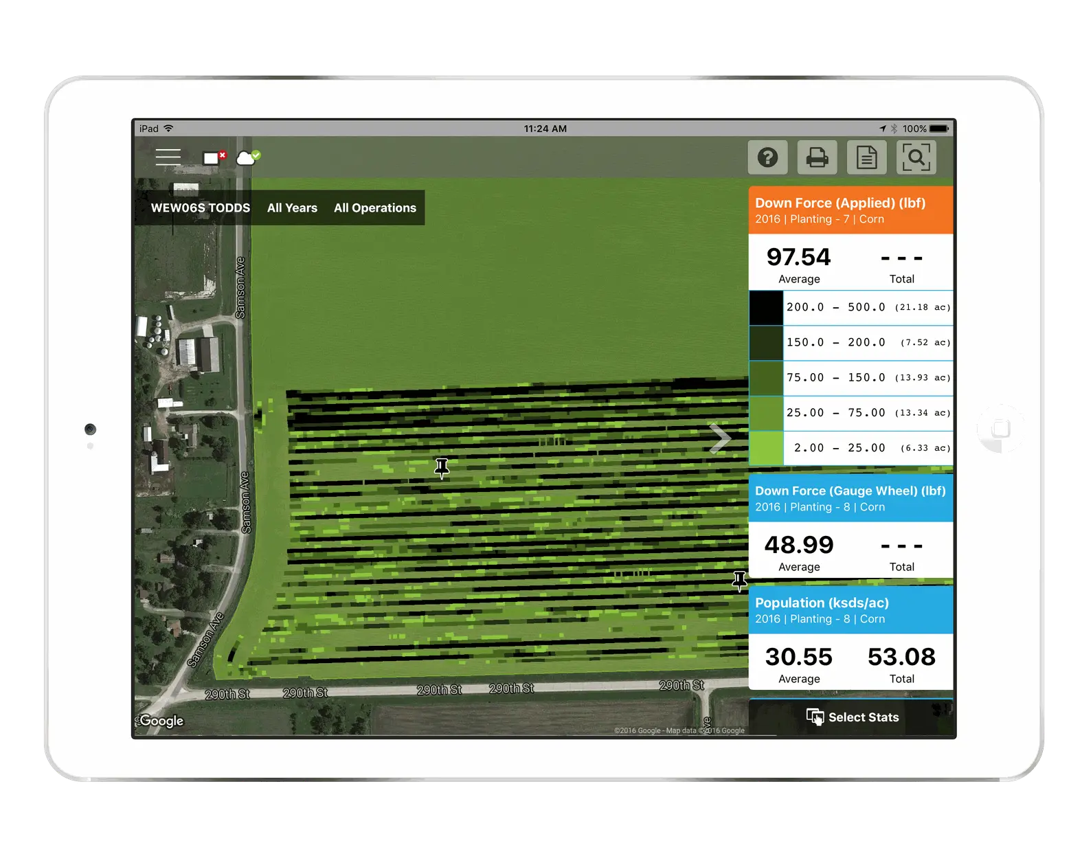
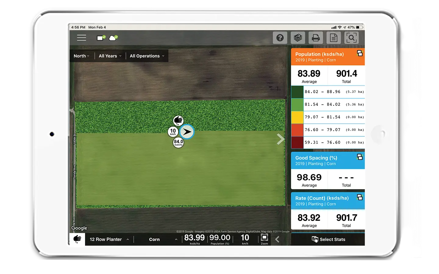
Planting
Choose seed based on historic yield performance, create planter performance reports and charts, and satisfy government reporting needs.
![]()
Application
Track variable-rate application operations, record application operations for recordkeeping, and create variable-rate prescriptions.
![]()
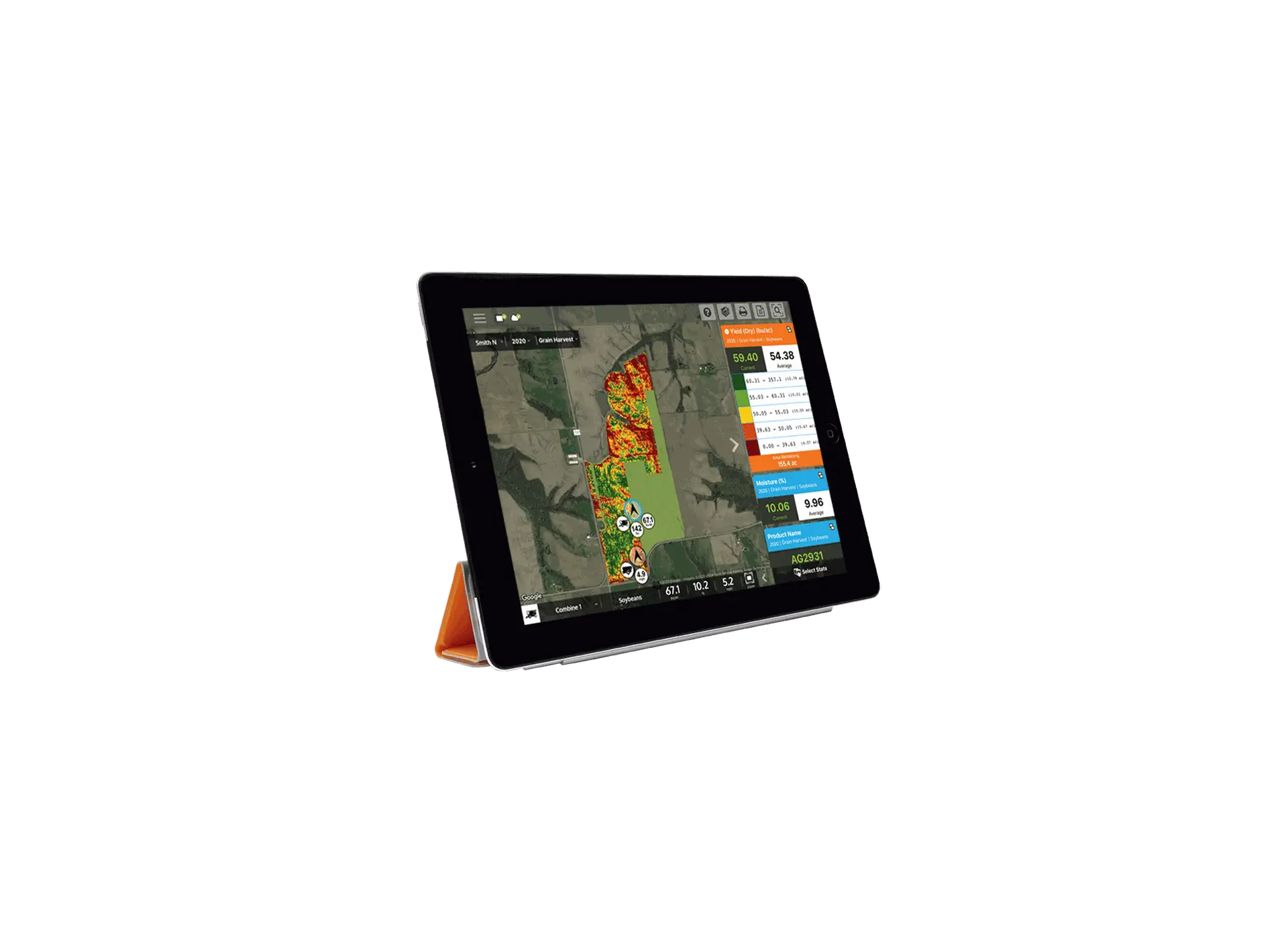
Harvest
Analyze harvest data, discover yield trends using multiple years’ data, create harvest reports and charts, or use query tools.
![]()
Field stewardship
Manage soil sampling, create field tile plans, download soil survey maps and view aerial and road background maps, and plan and document crop plans and practices.
Manage your Data
Get in touch with your customers to provide them with better service. You can modify the form fields to gather more precise information.